NASA Satellite Spots Tsunami: A Leap for Disaster Prediction
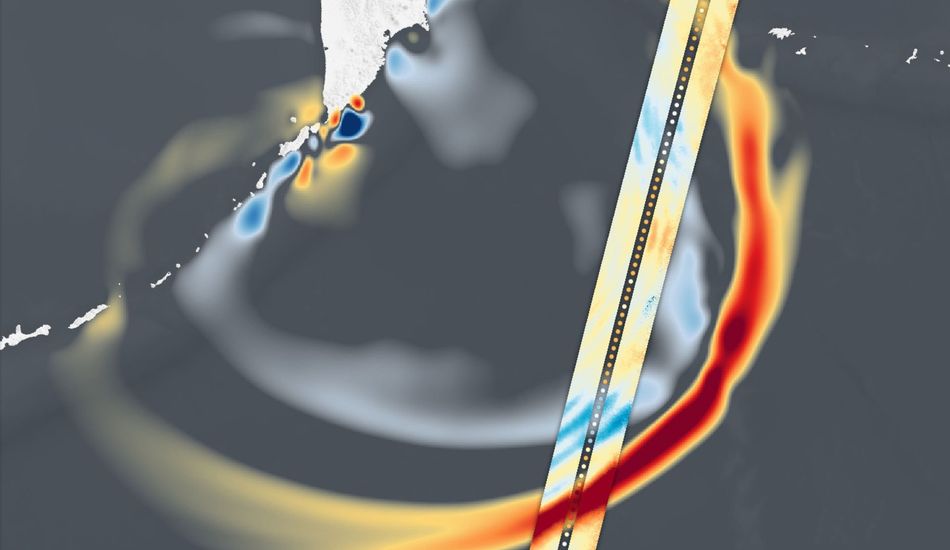
Hey everyone! Check this out: NASA's SWOT satellite recently captured some incredible data about the tsunami triggered by that massive 8.8 magnitude earthquake off the coast of Russia back in July. It's pretty wild to see how this tech is helping us understand these natural disasters better. The satellite, a joint project with the French space agency, CNES, managed to record the tsunami's initial surge just over an hour after the quake.
What's really interesting is how SWOT is helping to refine our tsunami forecasting. You know, that 1.5-foot wave might not sound scary, but as one NASA oceanographer pointed out, tsunamis are no joke because they affect the entire water column. Imagine that energy hitting a coastline – it can turn into a devastating 30-foot wall of water. Luckily, while Kamchatka got hit with waves up to 13 feet high, other areas like the U.S. West Coast and Hawaii saw much smaller waves.
SWOT's data is allowing scientists at NOAA's Center for Tsunami Research to improve their forecast models. This is super important because these models are what trigger tsunami alerts for coastal communities. Being able to more accurately predict the size and direction of these waves can save lives.
I think it's amazing how technology like SWOT is not only giving us incredible visuals of these events, but also helping us to better prepare for them. It's a great example of how space-based observation can have a real, tangible impact on our lives here on Earth. What do you guys think about this? Let me know in the comments!
Source: Gizmodo